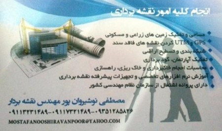
Projects:
Geodesy and breakdown of lands, residential and agricultural.
UTM storage map of the property and the lands lacking in the document for the issuance of the document, article 147.
Grid packing and leveling, drainage, and irrigation of agricultural fields.
The path of power transmission and construction.Computing volumes of excavation and embankment
Implement Foundation and Uxbridge column and excavation.
Training, equipment, and software mapping.
Do student projects.
Has the permit of construction engineering organization.
Has experience of 10 years and do various projects mapped across Iran
Ready to cooperate in all over Iran
Mustafa نوشیروان pour.Engineer surveyor
| Company | شرکت فنی مهندسی طراحان قائم راه گسر |
|---|---|
| Tel | +98 -9×××321489 |
| Country | Iran |
| Province | Mazandaran |